DIA 4 | DAY 4


Saia das Bananeiras em direção à Baía do Raposo. Neste geossítio, pode visitar as ruínas de duas azenhas, a levada que os alimenta e um lagar pertencente à cultura vinhateira do local.
Continuando para oeste, irá encontrar mais um geossítio, o Barreiro da Faneca, fruto da última fase eruptiva da ilha, onde predominam as argilas de cor avermelhada. Nesta fase do percurso, sobre terreno árido, existem vários desvios com acessos a miradouros sobre a costa norte, destacando-se o miradouro da Ponta do Pinheiro e o da Baía da Cré.
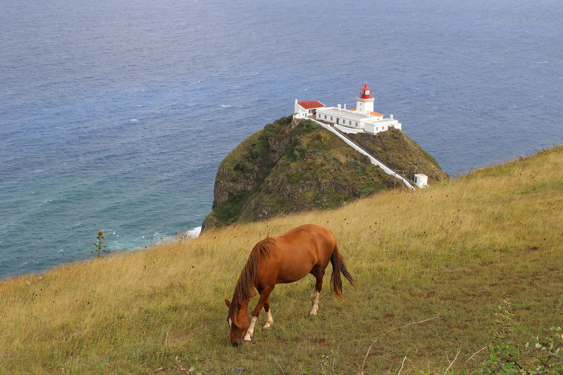
Chegando ao final desta zona árida, o percurso leva-o a subir o Monte Gordo, local onde existe uma vigia de baleia. Daqui sobe-se à Ponta dos Frades, continuando depois em direção aos Anjos. Nesta fase caminhe paralelamente à Ribeira dos Lemos, até chegar à estátua de Cristóvão Colombo, no centro da localidade.
Contorne a Baía dos Anjos pelos terrenos agrícolas circundantes e inicie a descida para a praia de calhau. Siga em direção ao porto de pesca e continue para a Ribeira do Capitão. Ao longo de um caminho de terra batida irá avistar a baía dos Cabrestantes e à medida que avança começará a surgir no horizonte o aeroporto. Esta parte do troço realiza-se num caminho circundante, entre a orla costeira e a vedação do aeroporto.
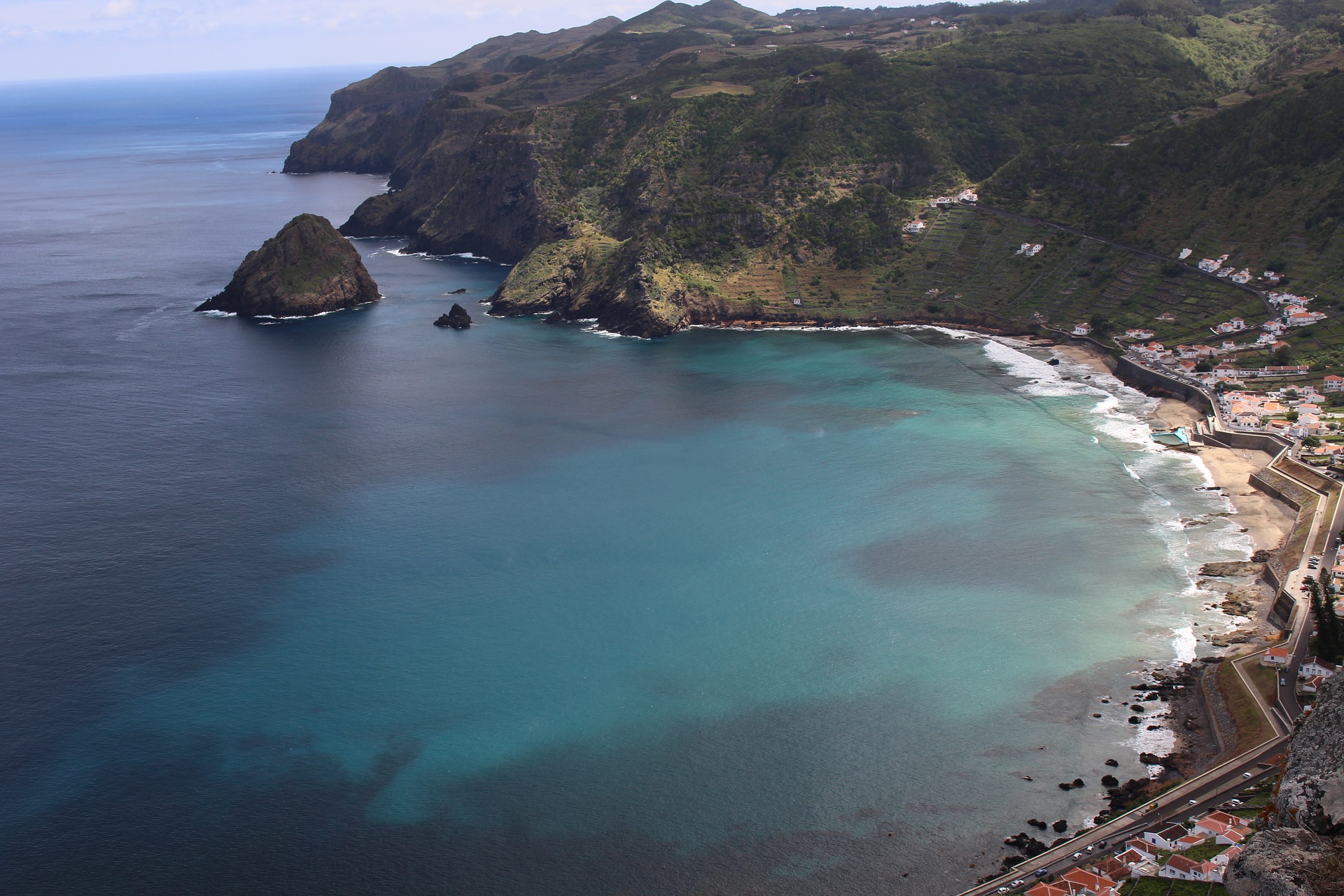
Ao atingir o fim do aeroporto, siga para a foz da Ribeira Seca, onde entrará numa área protegida com vista privilegiada para o Ilhéu da Vila. Daqui siga junto à orla marítima até à Ponta do Malmerendo.
A parte final do percurso é feita contornando a encosta, donde é possível avistar o porto comercial e o centro da Vila. O caminho de terra continua, sendo interrompido pela estrada de acesso à zona industrial, prosseguindo em direção ao centro histórico da Vila.
Exit the Bananeiras towards Raposo Bay. In this geosite, you can visit the ruins of two waterfalls, the levada that feeds them and a winepress belonging to the winemaking culture of the place.
Continuing to the west, you will find another geosite, Barreiro da Faneca, fruit of the last eruptive phase of the island, where predominantly reddish-colored clays. At this stage of the course, on dry terrain, there are several detours with access to viewpoints on the north coast, especially Ponta do Pinheiro and Cré Bay.
Arriving at the end of this arid zone, the route takes you to climb Monte Gordo, place where there is a whale watch. From here it climbs to Ponta dos Frades, continuing later towards the Angels. At this stage walk parallel to Ribeira dos Lemos until you reach the statue of Christopher Columbus in the center of the town.
Drive around the Baía dos Anjos through the surrounding farmland and start the descent to the pebble beach. Head towards the fishing port and continue to the Ribeira do Capitão. Along a dirt road you will see the Bay of Capstans and as you begin you will begin to appear on the horizon the airport. This part of the section takes place on a surrounding road, between the coast and the airport fence.
When you reach the end of the airport, head to the mouth of Ribeira Seca, where you will enter a protected area with a privileged view of the Ilhéu da Vila. From here follow along the seafront to Ponta do Malmerendo.
The final part of the route is made bypassing the hillside, where you can see the commercial port and the center of the village. The dirt road continues, being interrupted by the access road to the industrial zone, continuing towards the historical center of the Village.
